Showing 44 items matching emergency map
-
 Flagstaff Hill Maritime Museum and Village
Document - Map, Department of Lands & Survey, Victoria / Panmure, 1942
... Emergency Map...This Emergency Edition of the map of Panmure, Victoria..." Printed in red; “EMERGENCY EDITION”, “THIS MAP IS AN OFFICIAL...", "No. 930 / Zone 6" Printed in red; “EMERGENCY EDITION”, “THIS MAP ...This Emergency Edition of the map of Panmure, Victoria, is part of the W.R. Angus Collection. It was printed in 1942 during World War II. It is one of two maps donated to Flagstaff Hill Maritime Village by the family of Doctor William Roy Angus, who served as Surgeon Captain in the Australian Defence Department. The map was compiled for the Dept. of Army by the Dept. of Lands and Survey in Melbourne, prepared by the Australian Section of the Imperial General Staff, which was a British Government body created in 1907 to co-ordinate the defence of Britain and its Empire. It was printed by A.H.Q. Cartographic Company, Survey Corps, which was formed in 1941. The Corp changed its name to L.H.Q. Cartographic Company of Bendigo. In 1947 the name reverted back to the A.H.Q. Cartographic Company until 1955 when it became the A.H.Q. Survey Regiment. The W.R. Angus Collection includes historical medical equipment, surgical instruments and material once belonging to Dr Edward Ryan and Dr Thomas Francis Ryan, (both of Nhill, Victoria) as well as Dr Angus’ own belongings. The Collection’s history spans the medical practices of the two Doctors Ryan, from 1885-1926 plus that of Dr Angus who began practice in 1924. Dr. Angus served with the Australian Department of Defence as a Surgeon Captain during the Second World Was from 1942 to 1945. He served in Ballarat, Victoria, and in Bonegilla, N.S.W. until he suffering from a heart attack just before the war ended. ABOUT THE “W.R.ANGUS COLLECTION” - Doctor William Roy Angus M.B., B.S., Adel., 1923, F.R.C.S. Edin.,1928, was generally known as Dr Roy Angus. His working life included a position as a doctor with the Flying Doctor Service in Australia’s rural and remote areas. After many varied experiences Dr Angus and his family moved to Warrnambool in 1939 where he purchased “Birchwood,” the 1852 home and medical practice of Dr John Hunter Henderson. He was appointed on a part-time basis as Port Medical Officer in Warrnambool and held this position until the 1940’s when the government no longer required the service of a Port Medical Officer. Dr Angus was a surgeon at the Warrnambool Base Hospital 1939-1942. After further studies he commenced practice as an ophthalmologist in Warrnambool, pioneering in artificial eye improvements. He was Honorary Consultant Ophthalmologist to Warrnambool Base Hospital for 31 years and made monthly visits to Portland to perform eye surgery. Dr Angus and his wife Gladys were very involved in Warrnambool’s community with a strong interest in civic affairs. They were both involved in the creation of Flagstaff Hill Maritime Village, including the layout of the gardens. After his death on 28th March 1970 his family requested his practitioner’s plate, medical instruments and some personal belongings be displayed in the Port Medical Office surgery at Flagstaff Hill Maritime Village, and be called the “W. R. Angus Collection”. This Emergency Edition of the Map of Panmure is significant as an example of the documents prepared for the defence of Australia in World War 2. The Map is also significant for its connection between the Australian Army and the involvement of Dr WR Angus as a Surgeon in the Medical Services during World War II. The W.R. Angus Collection is significant for still being located at the site it is connected with, Doctor Angus being the last Port Medical Officer in Warrnambool. The collection of medical instruments and other equipment is culturally significant, being an historical example of medicine, administration, household equipment and clothing from late 19th to mid-20th century. Dr Angus assisted Dr Tom Ryan, a pioneer in the use of X-rays and in ocular surgery. The collection includes Dr Angus’s Army objects and is significant as an example of items issued to Doctors and Surgeons in the Medical Services of the Australian Army in World War IIMilitary map of Panmure, Victoria, Australia; part of the W.R. Angus Collection. Rectangular coloured map on cream paper for the Australian Army. Details include sea, waterways and land, contour lines, grid lines, names of districts, towns and roads, bridges, swamps, rail lines, cuttings, tracks, buildings (including blacksmiths), pumps, lighthouses, telegraph, telephones and electric transmission lines, and fire stations. The map has margin notes that include distances in miles to nearby towns. The map was compiled for the Dept. of Army by the Dept. of Lands and Survey in Melbourne, prepared by the Australian Section, Imperial General Staff and printed by A.H.Q. Cartographic Company, Melbourne in 1942. Crown Copyright Reserved. Inscriptions in red print state that it is and Emergency Edition and an Official document. An oval purple stamp includes the price.Printed in black; 'Victoria / Panmure", "No. 930 / Zone 6" Printed in red; “EMERGENCY EDITION”, “THIS MAP IS AN OFFICIAL DOCUMENT. IF FOUND, IT MUST BE HANDED / IN TO THE NEAREST MILITARY HEADQUARTERS OR POLICE STATION” Stamped: within concentric ovals (“- - - FOR SALE / PRICE 2/- / - - - - - OF THE ARMY”)flagstaff hill, warrnambool, flagstaff hill maritime museum, maritime museum, shipwreck coast, flagstaff hill maritime village, great ocean road, dr w r angus, dr ryan, warrnambool base hospital, flying doctor, surgeon captain, australian department of defence, royal australian army, world war 2, map panmure 1942, roy angus, port medical officer, nhill base hospital, military map, emergency map, military service australian army, department of army, department of lands and survey, a.h.q. cartographic company melbourne, panmure 1942, australian section, imperial general staff -
 Flagstaff Hill Maritime Museum and Village
Document - Map, Department of Lands & Survey, Victoria / Port Campbell, 1942
... Emergency Map...This Emergency Edition of the map of Port Campbell... / Zone 6" Printed in red; “EMERGENCY EDITION”, “THIS MAP...", "No. 932 / Zone 6" Printed in red; “EMERGENCY EDITION”, “THIS MAP ...This Emergency Edition of the map of Port Campbell, Victoria, is part of the W.R. Angus Collection. It was printed in 1942 during World War II. It is one of two maps donated to Flagstaff Hill Maritime Village by the family of Doctor William Roy Angus, who served as Surgeon Captain in the Australian Defence Department. The map was compiled for the Dept. of Army by the Dept. of Lands and Survey in Melbourne, prepared by the Australian Section of the Imperial General Staff, which was a British Government body created in 1907 to co-ordinate the defence of Britain and its Empire. It was printed by A.H.Q. Cartographic Company, Survey Corps, which was formed in 1941. The Corp changed its name to L.H.Q. Cartographic Company of Bendigo. In 1947 the name reverted back to the A.H.Q. Cartographic Company until 1955 when it became the A.H.Q. Survey Regiment. The W.R. Angus Collection includes historical medical equipment, surgical instruments and material once belonging to Dr Edward Ryan and Dr Thomas Francis Ryan, (both of Nhill, Victoria) as well as Dr Angus’ own belongings. The Collection’s history spans the medical practices of the two Doctors Ryan, from 1885-1926 plus that of Dr Angus who began practice in 1924. Dr Angus served with the Australian Department of Defence as a Surgeon Captain during the Second World Was from 1942 to 1945. He served in Ballarat, Victoria, and in Bonegilla, N.S.W. until he suffering from a heart attack just before the war ended. ABOUT THE “W.R.ANGUS COLLECTION” - Doctor William Roy Angus M.B., B.S., Adel., 1923, F.R.C.S. Edin.,1928, was generally known as Dr Roy Angus. His working life included a position as a doctor with the Flying Doctor Service in Australia’s rural and remote areas. After many varied experiences Dr Angus and his family moved to Warrnambool in 1939 where he purchased “Birchwood,” the 1852 home and medical practice of Dr John Hunter Henderson. He was appointed on a part-time basis as Port Medical Officer in Warrnambool and held this position until the 1940’s when the government no longer required the service of a Port Medical Officer. Dr Angus was a surgeon at the Warrnambool Base Hospital 1939-1942. After further studies he commenced practice as an ophthalmologist in Warrnambool, pioneering in artificial eye improvements. He was Honorary Consultant Ophthalmologist to Warrnambool Base Hospital for 31 years and made monthly visits to Portland to perform eye surgery. Dr Angus and his wife Gladys were very involved in Warrnambool’s community with a strong interest in civic affairs. They were both involved in the creation of Flagstaff Hill Maritime Village, including the layout of the gardens. After his death on 28th March 1970 his family requested his practitioner’s plate, medical instruments and some personal belongings be displayed in the Port Medical Office surgery at Flagstaff Hill Maritime Village, and be called the “W. R. Angus Collection”. This Emergency Edition of the Map of Port Campbell is significant as an example of the documents prepared for the defence of Australia in World War 2. The Map is also significant for its connection between the Australian Army and the involvement of Dr WR Angus as a Surgeon in the Medical Services during World War II. The W.R. Angus Collection is significant for still being located at the site it is connected with, Doctor Angus being the last Port Medical Officer in Warrnambool. The collection of medical instruments and other equipment is culturally significant, being an historical example of medicine, administration, household equipment and clothing from late 19th to mid-20th century. Dr Angus assisted Dr Tom Ryan, a pioneer in the use of X-rays and in ocular surgery. The collection includes Dr Angus’s Army objects and is significant as an example of items issued to Doctors and Surgeons in the Medical Services of the Australian Army in World War IIMilitary map of Port Campbell, Victoria, Australia; part of the W.R. Angus Collection. Rectangular coloured map on cream paper for the Australian Army. Details include sea, waterways and land, contour lines, grid lines, names of districts, towns and roads, bridges, swamps, rail lines, cuttings, tracks, buildings (including blacksmiths), pumps, lighthouses, telegraph, telephones and electric transmission lines, and fire stations. The map has margin notes that include distances in miles to nearby towns. The map was compiled for the Dept. of Army by the Dept. of Lands and Survey in Melbourne, prepared by the Australian Section, Imperial General Staff and printed by A.H.Q. Cartographic Company, Melbourne in 1942. Crown Copyright Reserved. Inscriptions in red print state that it is and Emergency Edition and an Official document. An oval purple stamp includes the price.Printed in black; 'Victoria / Port Campbell", "No. 932 / Zone 6" Printed in red; “EMERGENCY EDITION”, “THIS MAP IS AN OFFICIAL DOCUMENT. IF FOUND, IT MUST BE HANDED / IN TO THE NEAREST MILITARY HEADQUARTERS OR POLICE STATION” Stamped: within concentric ovals (“- - - FOR SALE / PRICE 2/- / - - - - - OF THE ARMY”)flagstaff hill, warrnambool, flagstaff hill maritime museum, maritime museum, shipwreck coast, flagstaff hill maritime village, great ocean road, dr w r angus, dr ryan, warrnambool base hospital, nhill base hospital, flying doctor, surgeon captain, map port campbell 1942, roy angus, port medical officer, military map, emergency map, australian department of defence, royal australian army, military service australian army, department of army, department of lands and survey, world war 2, a.h.q. cartographic company melbourne, australian section, imperial general staff, port campbell 1942 -
 Eltham District Historical Society Inc
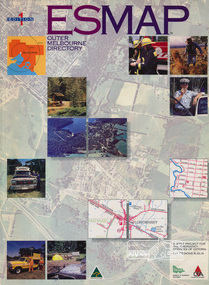
Book, Country Fire Authority Mapping Association Inc, ESMAP - Outer Melbourne Directory, 1991
... Outer Melbourne directory of information for emergencies... for emergencies with maps of the state and major towns emergency services ...Outer Melbourne directory of information for emergencies with maps of the state and major towns217 p. : maps ; 30 cm.ISBN 0646065661emergency services victoria -
 Frankston RSL Sub Branch
Map, SECRET LANDING GROUNDS AUSTRALIA
Large map of aircraft landing grounds located in Australia and some nearby Islands. This map shows landing grounds in use during the latter years of World War 2. The map is in Mercator Projection to the Equatorial Scale 1:4,000,000. The scale is statute miles. Each landing ground location is shown by a symbol indicating category and name. The legend explains the landing ground categories: RAAF Main Landing Grounds, RAAF Emergency Landing Grounds, Seaplane Anchorages, Civil Main Landing Grounds, Civil Emergency Landing Grounds and Cancelled Landing Grounds. The map was revised 4th September, 1945. The map is printed on paper which is attached to a linen backing, The map is quite faded and in a fragile condition. -
 Ringwood and District Historical Society
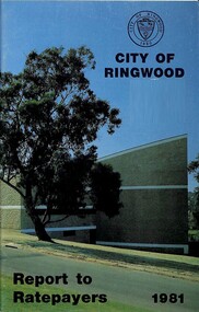
Booklet, Champion Press, City of Ringwood Report to Ratepayers 1981, 1981
Community booklet issued by City of Ringwood for 1981 - covering the facilities and activities of the Ringwood Council and other local organisations and associations. CONTENTS: (page number) Beautification and Leisure Areas 24 Building — General Information 21 Commissioners for Taking Declarations and Affidavits 15 Council Finance 11 Council Meeting Dates 5 Council Representation on various organisations 8 Councillors 6 Elections for Council 10 Emergency Telephone Numbers 51 Health -30 Home Help Service 22 Immunisation Programme 31 Infant Welfare Centres 33 Items of Interest 16 Justices of the Peace 14 Let's Be Neighbourly 20 Library — General 18 Library — Service for our Senior Citizens 23 Major Works 12 Map of municipality 26 Mayor's Message - Cr. F.J. Corr 4 Meals on Wheels 28 Members of Parliament 50 Officers of the Council 9 Proposed Leisure Centre 14 Rate Assistance 11 Rate Payments 10 Recycling Depots 49 Ringwood Cultural Centre 2 Ringwood Festival activities for 1981 29 Standing Committees of Council 5 Swimming Centre 13 Welfare and Community Services 34 rinx -
 Ringwood and District Historical Society
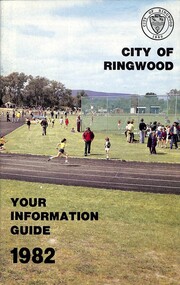
Booklet, City of Ringwood - Your Information Guide 1982, 1982
Community information booklet issued by City of Ringwood for 1982 - covering the facilities and activities of the Ringwood Council and other local organisations and associations. Cover photograph: A.C. Robertson Athletic Field. CONTENTS: (page no.) Beautification and Leisure Areas 16 Building — General Information 26 By-Laws 27 Circuit Bus — Ringwood City 54 Commissioners for taking Declarations and Affidavits 31 Council Meeting Dates 6 Council Representation 7 Councillors 4 Cultural Centre 32 Disabled Persons - Facilities 34 Elections for Council 10 Emergency Telephone Numbers 54 Festival 33 Finance — Council 12 Golf Course 30 Health Home Help Service 24 Immunisation Programme 20 Items of Interest 22 Justices of the Peace 30 Library — General 13 Library — Service for our Senior Citizens 26 Major Works Programme 14 Map of Municipality 28 Mayor's Message – Cr. N.J. Hamilton 2 Meals on Wheels 25 Members of Parliament 52 Officers of the Council 8 Property Records 10 Rates 11 Recycling Depots S3 Regulations 27 Roll — Municipal 10 Swimming Centre 21 Voting — Compulsory 10 Welfare and Community Services 35 rinx -
 Ringwood and District Historical Society
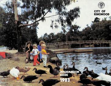
Booklet, City of Ringwood Information Guide 1983, 1983
Community information booklet issued by City of Ringwood for 1983 - covering the facilities and activities of the Ringwood Council and other local organisations and associations. Cover photograph: Ringwood Lake Reserve.CONTENTS: (page no.) Aged — Centre for the Frail Aged 22 Building — General Information 28 By-Laws and Regulations 27 Circuit Bus — Ringwood City 33 Commissioners for taking Declarations and Affidavits 29 Committees of Council 6 Council Meeting Dates 6 Council Officers 8 Council Representation 7 Councillors 4 Cultural Centre 36 Disabled Persons - Facilities 21 Emergency Telephone Numbers 58 Elections for Council 10 Festival 23 Finance - Council 11 Garbage Collection 58 Golf Course 37 Health 18 Home Help 25 Immunisation Programme 20 Immunisation Schedule 19 Items of Interest 32 Justices of the Peace 29 Lake — Ringwood Lake Reserve 59 Leisure Areas 16 Library — General 12 Library - Service for our Senior Citizens 26 Major Works Programme 14 Map of Municipality 30 Mayor’s Message – Cr. Pat Gotlib, J.P. 2 Meals on Wheels 24 Members of Parliament 56 Nature Strip Maintenance 34 Pensioners — Rate Assistance 11 Rates 10 Recycling of Waste 57 Roll — Municipal 10 Shuttle Bus 33 Swimming Centre 37 Voting — Compulsory 10 Welfare and Community Services 38 rinx -
 Ringwood and District Historical Society
Booklet, City of Ringwood 1985 Information Guide, 1985
Community information booklet issued by City of Ringwood for 1985 - covering the facilities and activities of the Ringwood Council and other local organisations and associations. Cover photograph: Lionsbrae - Frail Aged Hostel.CONTENTS: (page no.) By-Laws/Traffic Regs. 35 Chief Executive 10 Children's Service 12, 13 & 40 Churches 41 City Map 32 & 33 Committees of Council 7 Community Services 38 Community Services Officer 43 Council Finances 24 Councillors 4 & 5 Council Meeting Dates 6 Council Representatives 8 Cultural Centre 23 Disabled Persons Facilities 44 Eastern Corridor 18 East Ringwood Shopping Centre 22 Emergency Telephone Nos. 63 Garbage Collection 20 Golf Course 15 Health 26 Historical Research Croup 47 Home Help 30 Hospitals 48 Immunisations 27 Incinerators 21 Infant Welfare Centres49 J.P.'s and Commissioners 37 Library 28 & 29 Lionsbrae 17 Management Executive 11 Mayoral Message – Cr. R. Gardini, J.P. 3 Meals on Wheels 34 North Ringwood Senior Citizens 16 Opportunity Shops 53 Parks and Reserves 53 Parliamentary Representatives 9 Playgroups 55 Pre-schools 56 Public Toilets 56 Rates 25 Ringwood Croydon Advisory Service 37 Schools 58 Senior Citizens Centres 60 Swimming Pool 14 Unemployment 62 Victoria's 150th Anniversary 36 Works Programme 18 & 19 Youth Outreach Worker 62 rinx -
 Ringwood and District Historical Society
Booklet, Impact Printing (Vic.) Pty. Ltd, City of Ringwood 1987 Community Information Guide, 1987
Community information booklet issued by City of Ringwood for 1987 - covering the facilities and activities of the Ringwood Council and other local organisations and associations. Cover photograph: Ringwood Aquatic Centre at night. Middle page photographs: (from top L-R) Putting at Golf Course, Reclaimation work Mullum Mullum Creek, Poppett Head rear of Ringwood Lake, Wattle in bloom. (Middle row) Aquatic Centre Toddlers Pool, Fern Gallery at Lake, Aquatic Centre Diving Tank, Wedding at Ringwood Lake. (Bottom row) Lawn Bowls, Bike Path, Community Garden. Also includes lift-out City of Ringwood map.CONTENTS: (page no.) After School Care Programme 29 Aquatic Centre 12 & 13 Building Information 19 By-Law and Traffic Regulations 21 Chief Executive Message 10 Children's Services 28 Churches 40 Civic Centre 4 Committees of Council 5 Community Plan 11 Community Services 37 - 59 Construction Work 26 Council Elections 19 Council Meeting Dates 4 Council Representatives 8 Councillors 6 & 7 Disabled Persons Facilities 43 Domiciliary Care 30 Emergency Telephone Nos. 62 Family Day Care 28 Finances 16 Garbage 36 Golf Course 23 Health 25 Home Help 31 Immunisations 24 Incinerators 20 Infant Welfare Centres 45 Joint Use Facilities 35 Knaith Road Child Care Centre 28 & 29 Local Area Traffic Management 18 Management Executive 11 Mayoral Message – Cr. Lillian Rosewarne, J.P. 3 Meals on Wheels 30 Members of Parliament 9 Parks 23 Playgroups 53 Pre-Schools 53 Rates 17 Recycling 35 & 36 Ringwood By-Pass Road 15 Ringwood Convention and Performing Arts Centre 34 Ringwood District Centre 14 Schools 52 Swimming Pool - See Aquatic Centre 12 & 13 Town Planning 19 Vandalism 27 rinx -
 Eltham District Historical Society Inc
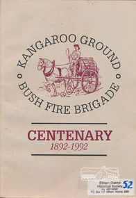
Book, Bruce Bence, Kangaroo Ground Bush Fire Brigade, centenary 1892-1992 : the story of the Kangaroo Ground Fire Brigade / Bruce Bence, 1992
Contents (described as Index): The early days, Ewen Hugh Cameron, 1914-1939, Supporting organisations, Eltham Emergency Operations Centre, Kangaroo Ground Fire Brigade Ladies Auxiliary, The fire tower, the Salvation Army and Red Cross, 1930-1992, The Kangaroo Ground Fire Brigade Today, Kangaroo Ground Fire Brigade Chronology. Includes a list of names of office bearers. Also includes references to neighbouring brigades and copies of historical newspaper articles. This publication was supported by the resources, information and facilities of The Shire of Eltham Historical Society.This book is significant in that not only does it traces the development of Kangaroo Ground Bush fire brigade since 1892 and of emergency services in the area but it also gives an insight into the people and their community.Softcover; 61 p., [7] p. of plates : b&w ill., 7 maps, ports.ISBN 064606651Xkangaroo ground, fire brigades, emeregency services, kangaroo ground fire brigade, fires, bush fires, shire of eltham war memorial, kangaroo ground tower -
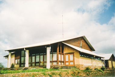 Eltham District Historical Society Inc
Photograph, Emergency Operations Centre, S.E.S., Kangaroo Ground
In 2017 known as the Kangaroo Ground Operations Centre a facility for hire managed by the Shire of Nillumbik. On 7 February 2009 (Black Saturday) the CFA Incident Control Centre (ICC) was located here. Described in "Worst of Days: Inside the black Saturday firestorm" by Karen Kissane (access via Google books): "..the ICC is part of a mud brick complex built in the 1980s as an emergency operations centre for several agencies, including the State Emergency Service. It is also home to the headquarters of the CFA's Lower Yarra Group. A small office with a whiteboard would be the incident controller's office throughout the office, but a larger central room, with data projectors, "smart boards" and maps would house the rest of the team.."Statement of Significance From the Victorian Heritage Database (2010) What is significant? The 1988 emergency operations centre and the surrounding site to the title boundaries. How is it significant? The emergency operations centre is architecturally, aesthetically, socially and historically significant to the Shire of Nillumbik. Why is it significant? The emergency operations centre is architecturally and historically significant as a good and rare example of a large public building constructed in a 1980s version of the 'Eltham style', and as a rare attempt to adapt the 'Eltham-style' aesthetic to meet the changing demands of the Shire in the 1980s (Criteria B, D & E). The emergency operations centre is architecturally and aesthetically significant because it is constructed of mud brick and features: a central entry with a tile mural (Criterion E). The emergency operations centre is socially significant because it is a focal point for the community and has played an important role in protecting the community since 1988 (Criterion G).Two colour photographs of mud brick Emergency Operations Centre building, Kangaroo Groundbuildings, mud brick, emergency centre, kangaroo ground -
 Victorian Aboriginal Corporation for Languages
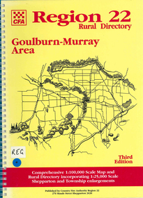
Map, Country Fire Authority, Region 22 rural directory Goulburn-Murray area, 1997
... -Murray area maps Goulburn region fire protection emergency ...mapsgoulburn region, fire protection, emergency services, victorian maps, directories -
 Victorian Aboriginal Corporation for Languages
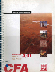
Map, Country Fire Authority, Region 18 rural directory, 2001
... emergency services Victorian regional maps Country Fire Authority ...Maps, colour photographsswan hill, mildura, mallee, fire protection, emergency services, victorian regional maps -
 Victorian Aboriginal Corporation for Languages
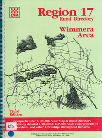
Map, Country Fire Authority, Region 17 rural directory : Wimmera area, 1997
... Street Brunswick melbourne Map Region 17 rural directory ...mapshorsham, wimmera, west wimmera, hindmarsh, yarramback, grampians, fire protection, emergency services, victorian regional maps -
 Victorian Aboriginal Corporation for Languages
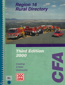
Map, Country Fire Authority, Region 16 rural directory, 2000
... , colour photographs Ararat fire protection emergency services maps ...maps, colour photographsararat, fire protection, emergency services, maps, victorian regional maps -
 Victorian Aboriginal Corporation for Languages
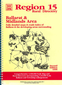
Map, Country Fire Authority, Region 15 rural directory : Ballarat &? Midlands Area : fully detailed maps &? roads index of Ballarat &? the developing areas surrounding, 1996
... protection Victorian regional maps emergency services Country Fire ...mapsballarat, fire protection, victorian regional maps, emergency services -
 Victorian Aboriginal Corporation for Languages
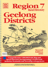
Map, Country Fire Authority, Region 7 rural directory Geelong districts, 1996
Shows roads, railway, power lines, buildings and emergency locations. Lists property owners.mapsgeelong, regional victoria, fire protection -
 Victorian Aboriginal Corporation for Languages
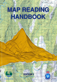
Book, Tasmania State Emergency Service, Map reading handbook, 1997
... Street Brunswick melbourne Book Map reading handbook maps, b&w ...maps, b&w photographs, charts, diagramsmaps reading, aerial photographic maps, global positioning systems, topographical maps, compasses -
 Kew Historical Society Inc
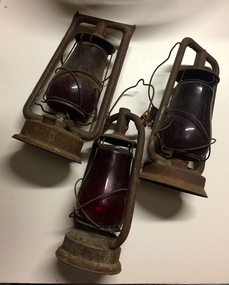
Equipment, City of Kew, Traffic Warning Lantern, 1945-1965
One of three traffic warning lanterns donated by the City of Kew in 1984. The lanterns were used by the City Engineers Department for emergency street lighting to indicate dangerous conditions. The red glass in the lanterns symbolically represented danger.The Kew Historical Society is fortunate that the City Engineer, Mr Poulter, donated a number of items held by the City of Kew to the Society for safekeeping, rather than identifying them for destruction. The most significant items donated included old maps, including those issued by the Board of Works. Other items included photographs of public works undertaken by the Department. These traffic warning lanterns, while less historically significant, are indicative of a period of rapid urban development in the district during the post war period.City of Kew warning lantern (left) previously located in various streets and plant nurserytraffic lanterns -- city of kew, emergency lighting, public works -- kew (vic.) -
 Kew Historical Society Inc
Equipment, City of Kew, Traffic Warning Lantern, 1945-1965
One of three traffic warning lanterns donated by the City of Kew in 1984. The lanterns were used by the City Engineers Department for emergency street lighting to indicate dangerous conditions. The red glass in the lanterns symbolically represented danger.The Kew Historical Society is fortunate that the City Engineer, Mr Poulter, donated a number of items held by the City of Kew to the Society for safekeeping, rather than identifying them for destruction. The most significant items donated included old maps, including those issued by the Board of Works. Other items included photographs of public works undertaken by the Department. These traffic warning lanterns, while less historically significant, are indicative of a period of rapid urban development in the district during the post war period.City of Kew warning lantern (centre) previously located in various streets and plant nurserytraffic lanterns -
 Kew Historical Society Inc
Equipment, City of Kew, Traffic Warning Lantern, 1945-1965
One of three traffic warning lanterns donated by the City of Kew in 1984. The lanterns were used by the City Engineers Department for emergency street lighting to indicate dangerous conditions. The red glass in the lanterns symbolically represented danger.The Kew Historical Society is fortunate that the City Engineer, Mr Poulter, donated a number of items held by the City of Kew to the Society for safekeeping, rather than identifying them for destruction. The most significant items donated included old maps, including those issued by the Board of Works. Other items included photographs of public works undertaken by the Department. These traffic warning lanterns, while less historically significant, are indicative of a period of rapid urban development in the district during the post war period.City of Kew warning lantern (right) previously located in various streets and plant nurserytraffic lanterns -
 Orbost & District Historical Society
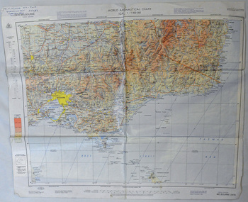
map, 1985
An aeronautical chart is a map designed to assist in navigation of aircraft. Using these charts and other tools, pilots are able to determine their position, safe altitude, best route to a destination, navigation aids along the way, alternative landing areas in case of an in-flight emergency, and other useful information such as radio frequencies and airspace boundaries. World aeronautical charts have a scale of 1:1,000,000 and cover relatively large areas. Orbost Aero Club began in 1969 with Basil Dowie as Chair, David Nixon as Secretary/Treasurer. The group went into recess from 1977-1991 closing in 1997. The mid 1960s were boom years in flying training in Australia and the number of Aero Clubs grew rapidly. The Club played a significant role in the establishment of the small airport at Marlo and in the ongoing operation and development of the airport over the years particularly for patient transfer by aerial ambulance. The Orbost Aero Club Club played a significant role in the establishment of the small airport at Marlo and in the ongoing operation and development of the airport over the years.A laminated map of eastern Victoria. A World Aeronautical Chart. It shows elevations, longitude etc and is designed for pre-flight planning as well as pilotage. Top left hand corner - D.F.N.Nixon VH-FWD 12 Kristine Ct Cheletenham 27/7/87orbost-aero-club aeronautical-map -
 Eltham District Historical Society Inc
Calendar, Nillumbik Community Calendar 1996: Nillumbik The Places and the People, 1995
Community Project. One of a series of calendars which the Shire of Eltham and the Shire of Nillumbik published annually Photography by Graham Hosking Photography. Monthly calendar printed in landscape mode, with feature photograph and template of dates for each of the 12 months presented. Includes advertisements. Back of the calendar includes a list of emergency numbers.calendar,1996,shire of nillumbik,research primary school,eltham north adventure playground,edendale gateway,tony trembath,eltham leisure centre,diamond valley railway,kangaroo ground pony club,eltham community and reception centre,eltham community centre,shire of nillumbik,swimming pool,yarra river,, diamond creek trail,yarrambat golf course,sugar loaf reservoir,map -
 Monbulk RSL Sub Branch
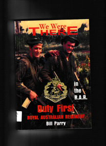
Book, Winston Oliver Parry, We were there in the R.A.R, 2005
A history of the Royal Australian Regiment from the malayan Emergency to the Iraq war.Ill, maps, p.289.non-fictionA history of the Royal Australian Regiment from the malayan Emergency to the Iraq war.australian army - royal australian regiment - history, soldiers - australia - anecdotes -
 Monbulk RSL Sub Branch
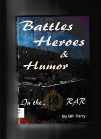
Book, Winston Oliver Parry, Battles, Heroes and Humour in the RAR, 2007
This book concentrates on the battles of the Korean War, Malayan Emergency, Borneo and Vietnam. I have once again endeavored to have the stories written by the real soldiers who were there. A number of the stories have been published before in books (ie) "Korea Remembered" and other military publications.Ill, maps, p.302.non-fictionThis book concentrates on the battles of the Korean War, Malayan Emergency, Borneo and Vietnam. I have once again endeavored to have the stories written by the real soldiers who were there. A number of the stories have been published before in books (ie) "Korea Remembered" and other military publications.australia - army - royal australian regiment, vietnam war 1961-1975 – personal recollections – australia -
 Monbulk RSL Sub Branch
Book, George Odgers, 100 years of Australian at war, 2000
A tribute to the servicemen and women of the past, and peacekeepers of the present, in the Australian Army, Navy and Air Force. Begins with the Boer War, goes on to cover the Boxers conflict in China, the First and Second World Wars, Malayan emergency, Korean War, Indonesia, Vietnam War, also the Gulf War, and East Timor.Index, notes, ill (b/w plates) (maps).non-fictionA tribute to the servicemen and women of the past, and peacekeepers of the present, in the Australian Army, Navy and Air Force. Begins with the Boer War, goes on to cover the Boxers conflict in China, the First and Second World Wars, Malayan emergency, Korean War, Indonesia, Vietnam War, also the Gulf War, and East Timor. australia - armed forces - history, australia - history - military -
 B-24 Liberator Memorial Restoration Australia Inc
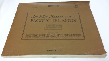
Map Book, Air Pilot Manual of the Pacific Islands, 3.1.1944
Part of pilot equipment to be carried at all times whilst flying in the South Pacific war zone during WW11Kept up to date and confidential maps for landing areas on all Pacific Islands in case of emergencyLarge linen covered paper map bookAir Pilot Manual of the PACIFIC ISLANDS, confidential, No.4860, 2nd Issue. Office of the ASSISTANT CHIEF OF AIR STAFF INTELLIGENCE Headquarters Army Air Forces, Washington D.C. January 3rd 1944. -
 Ballarat Tramway Museum
Book, Branford Electric Railway, "The Branford Electric Railway Timetable No. 9", 1977
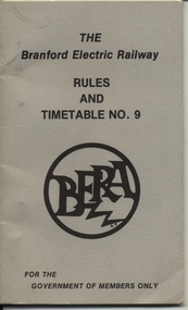
Forty page booklet individual pages pinned within grey covers titled "The Branford Electric Railway Timetable No. 9", dated 1/3/1977, authorised by D. K. Bowers Superintendent of Transportation. Gives Emergency Information, contact numbers, definitions, rules, timetables, special instructions and a map of the rail line. .Published by the Branford Electric Railway (Pennsylvania USA) for information and training their crews, mid 1970'strams, tramways, instructions, training, street cars, rules -
 Melton City Libraries
Photograph, Edna Barrie, 1920, 1924, 1933 and 1940
SUMMARY - Edna (Myers) Barrie, 1918 – 2018, Profile Early Life Edna was born at Melton and delivered by Hannah Watts. Her mother Martha walked in the dark at night with her basket under her arm to the bridge over the Toolern Creek Bridge and into Sherwin Street to the corner of Yuille Street to Hannah’s house Lynch Cottage. Martha’s husband was away shearing and eventually heard the news of the birth of their blue eyed third child and second daughter. She was born into a family that was surrounded by music; her father played the “squeeze box” and mother the mouth organ. From an early age the family were aware of the great composers, a framed picture of Beethoven, Chopin, Schubert and Wagner hung above the door to the lounge room of their 4 roomed cottage, the room where the piano stood. Her life on stage started as a singer aged 6 years at the Melton Mechanics Institute Hall. Edna was born with a natural ear for music learning piano and singing from her older sister Marjorie who became an accomplished pianist and soloist and renowned music teacher in Melton and district. In the 1920s and 1930s concerts at the Melton Mechanics Institute were regular events were the local talent was fostered. The Myers children, like other children of Melton and Rockbank, studied singing, piano and elocution, sat examinations, entered in competitions in South Street Ballarat, Footscray and Melbourne. In 1929 a Sacred Concert was broadcast by 3AR from the Hall as part of the Back to Melton Celebrations. Marjorie Myers performed two of the items on the piano. Edna attended Melton State School 430 from 1924 – 1933. Her father Fred had also attended the same school. In 1924 the School staged Cinderella at the Melton Mechanics Institute Hall with a cast of 33 students. After completing her education a Melton she boarded in South Melbourne and attending Melbourne Girls High School (MacRobertson Girls High School), a school which recognized her musical attributes. She travelled home on the train on the weekends, sometimes getting off at Rockbank to save a few pennies in fares. Working life The early 1930s the Depression was a difficult time for a young woman to find work. Jobs were often menial and given to the youngest and therefore cheapest applicant. She worked as sales assistant at Polonskis and Myer in the city, and Irvines Modes in Footscray. Working to 1pm on Saturday, and when held up by a customer meant missing the train home. While at Myer Department store she lived at home and rode her bike to the Melton railway station. On one occasion she had a nasty fall when a part of her bicycle came loose causing the bike to crash rendering her concussed and injuring her nose. During the 1930s she was given a camera “a little snap” by Mrs Kelly her landlady. This began her interest in photography documenting family life at their “Burnbank” home. Musically, while at Myers she participated in annual performances held at The Kings Hall and the Myer Mural Hall. Working in the basement at Myers she was often embarrassed when her name was called, customers assuming she belonged to the Myer Family. Ken Myer worked in the basement at the same time handling the ‘Wheeler’, a wicker basket used for moving goods around the store. The family philosophy was for the children to start at the bottom and work their way up. Social life Social life in her teenage years was connected also with Scots Presbyterian Church. She attended Sunday School classes and received book prizes for attendance. She loved to read and welcomed the times when she received new book. She took part in the Sunday School Anniversaries and was presented with a Bible from the Superintendent, Henry Robinson for her assistance with the music. Marriage and War years In 1941 Edna married Ernest “Bonnie” Barrie. War in the Pacific was soon to break out. While in Sydney on their honeymoon they met up with Jim Barrie who was on his way to Canada via Hawaii just missing Pearl Harbour by two days. Jim became a Spitfire Pilot and joined the RAF and was based in England. He returned to Australia later in RAAF to fight the Japanese off the coast of New Guinea. The three eldest Barrie brothers were farmers and food producers and were thus except from military service. Edna and Bon were members of the VAOC- Volunteer Air Observers Corp entailing being rostered on duty as plane spotters. The women took shifts during the day and the men at night which involved staying overnight in the Shire Offices. Later the spotting tower was built in the plantation opposite the Post Office. Edna and Bon carried on with this from their home in Ferris Rd when the threat of invasion had ceased Community life Community life in Melton revolved around fund raising events for the Melton Mechanics Institute for the War effort and keeping up with maintenance for the Hall. In 1944 the Minister for Health gave approval for the Shire of Melton to open and Infant Welfare Centre inviting Edna to form part of the Committee with seven other women. In 1948 she was President of Melton Branch of the Victorian Health Centres Association. She volunteered this use of her car driving the person in charge, Sister Smith to visit mothers and their babies. In 1963, along with Betty Jones and Isabel Snell, Edna was instrumental in forming the 1st Melton Cub Pack and later supported the formation of the 1st Melton Scouts. During 1963 – 1968 she completed the Australian Boy Scout Association Cub Pack Preliminary Training and achieved her Wood Badge. Country Women’s Association In 1944-1996 she was a member of the Melton Branch Country Women’s Association (CWA), Melton Branch, Secretary of the Branch in 1945 – 1946 and Branch International Secretary 1970-1971. She worked with choir, music and drama interest groups within the branch attaining both first and second place in 1959, second place in 1952 Exhibition and second in Music in 1960 in the state. She was involved in their handicraft craft events, fund raising and musical events and singing competitions. During the 1950s she trained Trios and Quartets in part singing for the CWA competitions in Ballarat and Melbourne. It was at this time that she developed her skill as a conductor and trainer of choirs. She later auditioned for the Victorian Choir for alto parts believing she would stand a better chance of being chosen, because of her ability to sing in natural harmony. In 1962 she participated in the Tenth Australian Country Women of the World (ACWW) Triennial Conference “Australia Presents: CWA Massed Choir” in the Melbourne Town Hall. This event was recorded by Super Sound Spotlight on 45 extended play vinyl record. The songs were Australian music and words, for example The Silver Stars are in the Sky, The Graceful Swaying Wattle and Kookaburra. Edna continued with her interest in the Victorian Choir regularly meeting at the CWA Headquarters in Toorak for rehearsals. In 1974 she took part in the Australian Choir at the fourteenth Triennial conference of the ACWW Interfaith Service held at the Perth Concert Hall on the 13th of October. Arts and Culture Edna was also in the Choir of 3KZ Carols by Candlelight at the Myer Music Bowl in 1963 and 1964. Melton Choral Society. Edna was Director and Conductor in the 1970s performing at many community events such as Carols by Candle Light, Church Services, Easter and Palm Sunday services, Mothers Union and the 1976 Community Services Week Combined Church Service. The October – November 1978 Program covered the following: songs from the Musicals, Choral and Solo with Narratives, Guest Instrumental Item, Recitation Negro Spirituals and Australian Songs. Her involvement with church choirs included the Scots Presbyterian Church Choir Easter and Christmas performances and the 1967 Centenary Service. In 1980s the Melton Uniting Church Sacred Music Performances included The Crucifixion by Stainer, The Olivet to Calvary and other church Hymns. Edna was Musical Director of the Melton Amateur Theatrical Society and worked on performances in collaboration with Mabel Rogers on script and musical interpretation. Melton and District Historical Society Annual Art and Craft Show. First held in Melton Mechanics Institute Hall in 1973, it later took place in the in the Melton Community Hall. The Art Show was also run in conjunction with other community organizations such as Rotary and Girl Guides. Community history and research Melton streetscape and society Over 20 years commencing in the 1970s, Edna undertook extensive photographing of the changing streetscape of Melton’s High Street. She anticipated the impact of change on the community during the time of Melton’s rapid transition from a small farming district to a large urban community and this led to her extensively document and photograph many of the structures and landscape features of the township that have since been lost. She also meticulously recorded much of the contemporary life of the town and has left a significant legacy of archival material. Melton State School 100 Years Celebration, October 1970 Co-author with Mabel Rogers “The First 100 Years, 1870 – 1970” Assembled a collection of School Class Photograph and identified and compiled lists of names for future school history. She also assembled a photographic display for the 125th anniversary in 1995. Melton and District Historical Society (M&DHS) Foundation Member, 1968 Held President and Secretary positions from its inception Research associated with the classification of Heritage buildings Christ Church Classification C Scots’ Presbyterian Church Classification D Set up the storage and Catalogue system in the Office at the Willows Organised society visits to Heritage sites in and beyond the Shire of Melton, including Stathtulloh, Eynesbury, Deanside, ToolernVale sites including Merrywood (now demolished) Staughton Vale, Chirnside, Point Cook, Shwerkolts Cottage. 1970 – 1983 Melton and District Historical Society Letterhead. Staughton Memorial Light from early newspaper cutting in its location before restoration to present location. Sketch by Wendy Barrie. Designing and printing pamphlets, stationery, and other sale items with Willows title. M&DHS street naming research for new housing developments (1970 – 2000). Collaborated with Mary Tolhurst to research the names of early landowners and pioneer families connected to the first settlers. Researched Aboriginal names for inclusion on lists submitted to developers. An early example is the naming of Kuranjang and the street names associated with the McPherson family. Plains of Promise (Shire of Melton history) by Joan Starr (1985). Edna assisted with Historical Society materials and contributed her own research and photographs. Contacted and organised for Hubert Opperman to launch the book. (She was also present at his last bike ride at Rochester in 1995.) Western Metropolitan Groups of Historical Societies. Member attending meetings and representing Melton, also hosted the Group at Melton The Willows Member of the Committee of Management for the restoration of the “Willows” house the establishment of The Willows Park 1982 March - Official Opening of the Willows Park- Preparation and planning for the event. Involved in the collecting of items in the furnishing of the display rooms in the Willows house. Donated items and furniture from the Myers and Daley family houses. (19th century) Machinery Shed Establishment. Involved with Jeff Robinson in the construction and collection of machinery display Other significant sites Championed and participated in the restoration and preservation significant sites in Melton, including: restoration of the Staughton Memorial Light and its return to its present site restoration of the Pykes Grave (using EW Barrie earthmoving equipment) restoration and reconstruction of Dunvegan restoration and reconstruction of Macs Cottage, the management and Caretakers residence Melton State School War Memorial Gates removed from Unitt Street entrance and relocated to the Willows Park Donated the Barrie family single furrow plough which was standing at the Court House Plaza. It removed and to Council Depot and later missing. The plaque was taken to the Willows. Jimmy Melrose (aviator) cairn restoration at crash site in Melton South Donald Mackintosh (Olympic gold medallist marksman) grave site at the Melton Cemetery (Historical items held by the Myers family collection.) Houdini first flight at Diggers Rest. Edna’s father was shearing at Diggers Rest at the time and witnessed the flight. She attended the 90 year anniversary of the event at the site in 2000. Radio and electronics Edna’s husband Bon interest in wireless communication dates in the 1920s with the building of a crystal set in the early days of public broadcasting. At the Back to Melton Celebrations in 1929, 3AR broadcast a concert from the Melton Mechanics Institute on the 20th February at 8pm featuring Footscray City Band, James Hill baritone, Vera Carew Soprano, James Foran Tenor, Marjorie Myers Piano, and James Williamson Entertainer. Accompanists: Miss Agnes Ross and Mrs James Hill. The Myers children had recordings of their piano playing made onto the aluminium records, Martha Myers’ voice can be heard introducing an item. These were made in a studio in Melbourne. Marjorie was given a upright Gramophone by Donald Mackintosh in recognition of her talent and her contribution to the cultural life of Melton. The family were then able to listen to 78rpm recordings of the famous classical recordings. The turntable was hand wound metal stylus needles had to be regularly replaced. The aluminium disk needed a bamboo needle to prevent damage to the surface. Before electricity was introduced to Melton in 1939 the Mechanics Hall relied on generators to produce electricity. Bon Barrie, being mechanically minded, built a public address system for be used a community functions at the Hall and Recreational Park. By 1939 this was up and running and used for over three decades. A large Collection of 78rpm records provided music for dances, marching, parades and any public event needing music and microphones. The early system was portable and worked on batteries. CFA Radio Communication In the 1950s with the introduction two-way HF and later VHF very high frequency radio sets. Melton Rural Fire Brigade was part of the Bacchus Marsh Group. Radio sets where located in the Melton Fire Truck, and in the house of the Barrie family at Ferris Road. This was an ideal location to observe a 360 degree view in all directions when smoke appeared on the horizon. An antenna was erected beside the house. The set OX 7 was located in the kitchen and monitored 24 hours by the family. When an electrical fire occurred at the junction of the electricity to the house there was time to radio the fire station and summons the men working in the paddocks, thus saving the house from possible destruction. With the introduction of UHF – ultra high frequency Vinten Radios the signal was clearer and static and interference lessened and radio traffic became easier to read, and reduced noise levels in the household. VL3 LY Radio Base became the Group Headquarters was established in 1967. By 1970 the Brigades were: Melton, Rockbank, Sydenham, Toolern Vale, Diggers Rest, Truganina, and Werribee. In 1974 when the family moved to First Avenue, another antenna and a small building were erected adjacent to the residence and used to house the equipment, maps. Radio traffic consisted of regular schedule times and communication with adjoining groups of brigades such as Bacchus Marsh, Mt Macedon and Little River Groups. Many of the brigade and group base radios were situated in private residences and operated primarily by fire fighters wives who held the position of Communications Officer, either registered as a brigade member or informally. Edna was never registered as an operational brigade member but operated informally as an assistant to her husband Bon. She was however a member of the Melton Fire Brigade Ladies Auxiliary from its inception in 1968, a non-operational position. Edna kept up to date with radio procedure following the 1967 handbook; preparing maps, plotting compass points and taking notes on weather forecasts from the SA Border and Western District. Daily notes were taken in anticipation of fire warnings. These log books and daily radio traffic were incidental to the regular radio schedules. Emergency turnouts noted, burning off times and predicted location of smoke. In the summer fire season all TBF (total fire ban days were recorded.) In times of emergency the Barrie family assisted Bon the base radio operator to plot the position and location of fire trucks and to help clarify garbled radio traffic, keep notes and make telephone calls. These log books are held in the EE and EW Family Archive. Melton Uniting Church Edna founded the Church Opportunity with Maisie Robinson in 1975 in the Melton South Methodist Church building. Methodist and Presbyterian Churches of Melton had combined severing their long held connection with Bacchus Marsh. A Manse had been recently built for the Melton Minister. At a Parish Committee meeting at the Melton South Church it was suggested to use the building as an Opportunity Shop. It opened in July 1975, and it raised $1,600 contribution to the church budget in 1976. In 1977 The Uniting Church in Australia was formed and the Melton South Uniting Church Opportunity shop continued to go from strength to strength expanding the buildings providing the welfare needs of the community. Archive Set up by Edna Catalogued items dating from 1857 Minute Book and set ongoing system and storage of items of heritage. Melton Un Awards and recognition of service to the Melton community Rotary Award for Community Service, 1980 Victoria 150th Anniversary Celebrations contributions, 1985 Life Membership of the Melton and District Historical Society (M&DHS), 1989 Extra-Ordinary Contribution for years of service to M&DHS, 1992 Long Service for Exceptional Service MD&HS, 1993 Royal Historical Society of Victoria Award of Merit, 1997 Shire of Melton Certificate of Appreciation for continued support and dedication as a member of MD&HS to the preservation of Melton’s History, 1998 Centenary of Federation Peoplescape (Canberra) Melton Shire nomination, 2001 Uniting Church Melton Life Membership of the Opportunity Shop Uniting Church in Australia Commission for Mission for 30 years of hard work and dedications to the Uniting Church, 2007 Uniting Church Adult Fellowship Certificate appreciation in recognition of valuable support through the “Sammy” Stamp Fund Neighbourhood Watch 5 year award Photographs of Edna at different ageslocal identities -
 Melton City Libraries
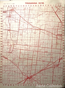
Map, Truganina R.F.B, 1964
The Mount Cotterill Group encompassed the Rural Fire Brigades of Melton, Rockbank, Sydenham, Toolern Vale, Truganina, and Werribee and later Diggers RestMap belonging to the Truganina Fire Brigade emergency services